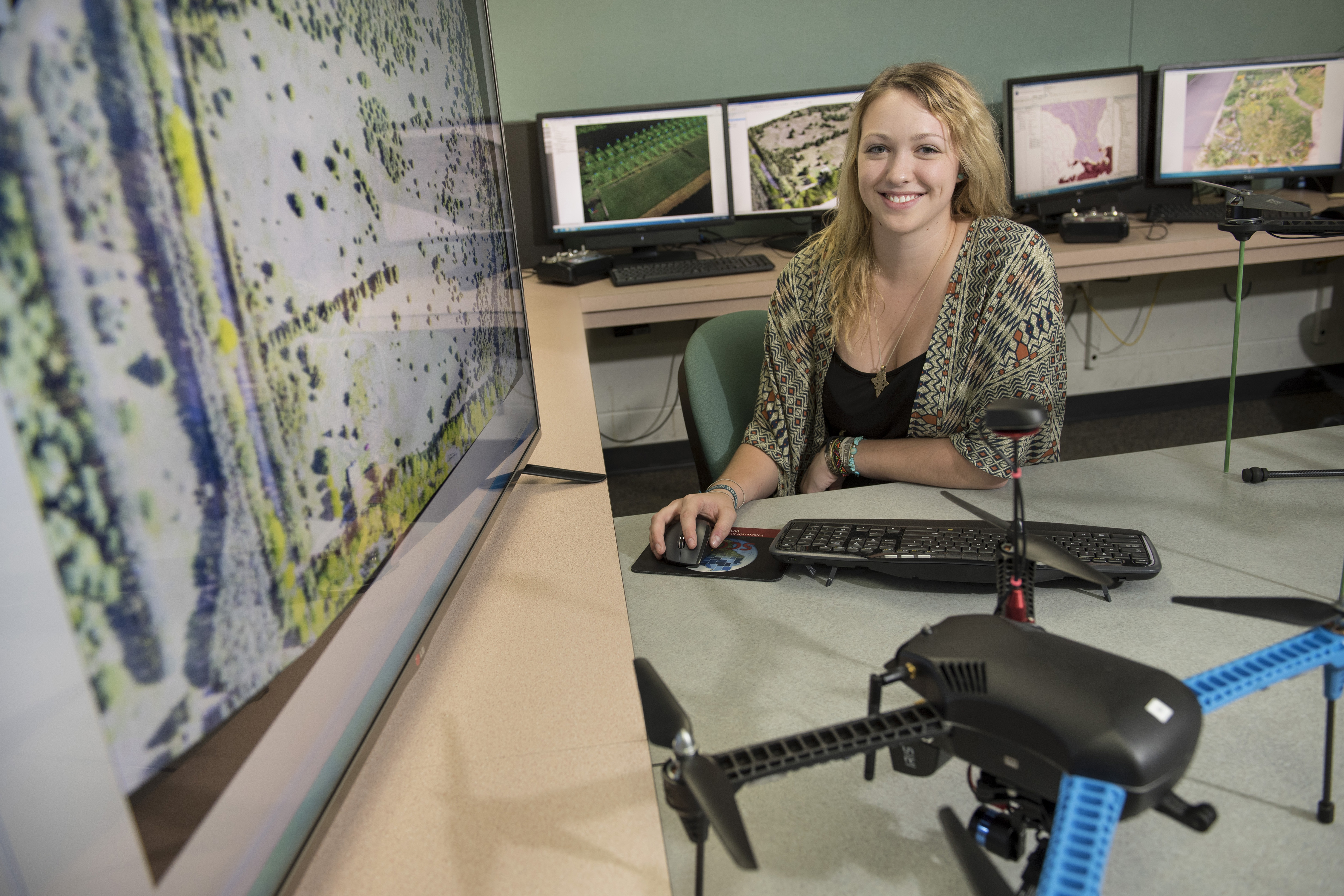
Syler Behrens won’t graduate from UW-Eau Claire until May 2016 but she’s already helping to shape how geospatial technologies will be used in the booming commercial unmanned aircraft systems industry.
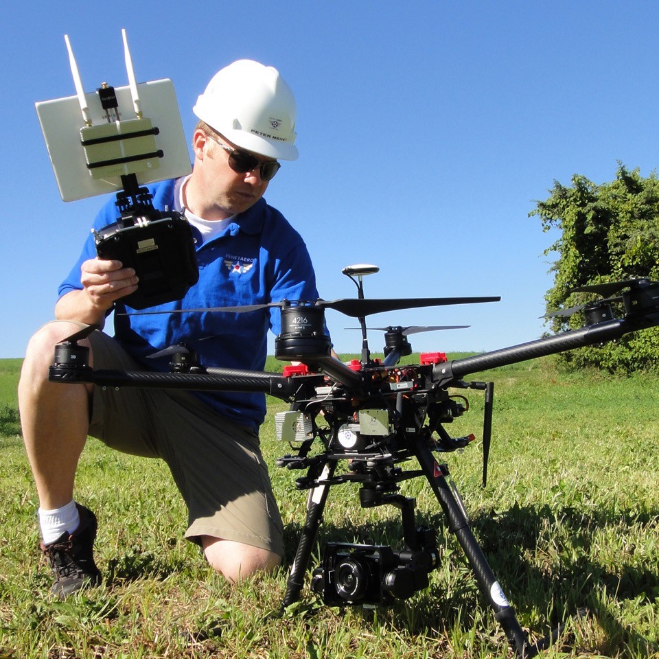
Behrens, a senior geography and biology major with a talent and a passion for geospatial technologies, is working as an intern for Menet Aero Inc., a Milwaukee-based business that holds one of the few FAA exemptions in Wisconsin that allows them to legally fly drones for commercial purposes.
“We are on the cutting edge of a multi-billion dollar market, and our UW-Eau Claire intern is truly helping to write the book on commercial UAS GIS operations,” Peter Menet, the owner of Menet Aero, says of Behrens’ contributions to his business.
Menet Aero provides aerial data-collection services to companies that can benefit from UAS, but may not have the aviation expertise, time or resources to develop an in-house flight department.
A pilot in the Wisconsin National Guard for nearly 20 years, Menet knows the aviation industry inside and out. His company owns state-of-the-art drones, and he has the FAA credentials necessary to legally fly drones on behalf of businesses and industries.
But Menet is looking to Behrens to help his company develop and determine the full capabilities and best practices of using UAS technologies, and the best methodology to use when applying the technologies to a variety of situations for his clients.
“UAS technology is developing rapidly,” Menet says. “New products enter the market every day, offering solutions that were otherwise inaccessible or economically unpractical. We’re working in unchartered territory, and having the expertise and enthusiasm of students and university experts within our reach is a huge asset as we develop the expertise necessary to serve clients’ UAS-aided GIS needs. I hope to learn as much from them as they learn from Menet Aero’s decades of global aviation experience.”
Real estate and insurance companies are examples of businesses and industries with a growing interest in making better use of UAS technologies. Images captured by UAS can help an insurance company quickly assess damage in an area harmed by a natural disaster, while it also can be used by real estate companies to share images of land or houses in ways not possible before.
Given the many and varied potential UAS applications, Menet says he needs to find a balance between what is possible and what is economically viable for his company.
“I hope that this partnership with UWEC will give us the opportunity push the limits of UAS capabilities but realize when we are passing a point of diminishing returns,” Menet says.
Behrens, a Brookfield native, says she’s up to the challenge.
“I’ve been fortunate to conduct research in the geography department but to have the chance to work in the private sector with such a revolutionary company is an amazing opportunity,” says Behrens. “I’m especially looking forward to taking on a more commercial approach to the geospatial side of UAS, including data processing and developing the final product for clients.”
Building partnerships between the university and private businesses like Menet Aero is among the goals of the University of Wisconsin-Eau Claire’s Geospatial Education Initiative, funded by a $418,869 grant from the Growth Agenda Wisconsin Grants Program.
The university-business connections create internship opportunities and bring students to the attention of potential future employers, says Dr. Joseph Hupy, associate professor of geography at UW-Eau Claire.
The interactions with private businesses also help faculty stay current on business and industry needs, ensuring that students graduate with the kinds of skills that are in high demand, he says.
Having the university expertise and its state-of-the-art technology available to them benefits businesses — like Menet — that want to use geospatial technologies to grow their business but aren’t yet to the point where they can manage it on their own, Hupy says.
“Right now, the technology is so new that that the market he’s entering is limited,” Hupy says of Menet. “He needs our expertise to help him move into the bigger markets and establish himself as a leader in the field. We have the skills to help him get there.”
It was UW-Eau Claire’s growing national reputation as a leader in geospatial technologies and GIS education that first caught Menet’s attention.
But it was Hupy’s expertise and enthusiasm for the technology that convinced him to partner with the university.
“I’d been referred to Dr. Hupy by several trusted advisers who had heard about the cutting-edge work he’s doing with drone technology,” Menet says. “I reached out to him and after a 10-minute phone call I knew I needed to visit UW-Eau Claire in person. I could tell from a short conversation how passionate he is about his work. I made the four-hour drive, and I was thoroughly impressed with Dr. Hupy and the UWEC geography program. I’m very fortunate to have made the valuable connection with such a leader in the field, and I look forward to working with him and his team for years to come.”
After Menet contacted him, Hupy offered advice and accompanied Menet when he flew a mine with his UAV. But it was clear that Menet needed more than Hupy could offer given the demands of his work as an educator, researcher and student adviser.
“Peter’s business is young and he’s looking to grow it, but he realizes he doesn’t know it all yet,” Hupy says. “He has the credentials to fly legally, and we have the geospatial expertise. There was so much potential there for us to work together.
“I told him that while I couldn’t work with him all the time, I could offer him a student intern. He was excited. He knows there is going to be a continuous need in his business for people with the kinds of skills our students are gaining here.”
Behrens was a perfect fit for the Menet Aero internship because her areas of expertise and interests matched the business’ needs so well, Hupy says.
Behrens welcomed the opportunity.
“It’s such a new technology that has such a wide variety of possible applications, from aiding in search and rescue to surveying properties and even creating 3D models of buildings,” Behrens says. “I have a lot of experience working with remote sensing and utilizing satellite imagery to conduct analysis on the environment. I’m applying that background to my work with UAS in my internship with Menet Aero. I am hoping to gain a better understanding of this new technology and how it can be used in a variety of disciplines.”
Behrens became interested in UAS and related technologies after enrolling in Hupy’s geospatial field methods class. At the time, she was a biology major looking to set herself apart by gaining GIS knowledge that she could apply to her biology studies.
She quickly discovered she had a passion for GIS, and was so impressed by the geography faculty that she decided to double major in biology and geography.
“The GIS program is unique; it offers students amazing opportunities like the one I was given to work with Menet Aero,” Behrens says. “So few undergraduate students have the chance to be exposed to UAS and here I am being mentored directly by my professors and a private business owner to develop my skills in this particular field. The faculty in this department are so knowledgeable and give so much to their students by working hand-in-hand with them.”
Behrens says she also appreciates that the university investment in state-of-the-art technology that is making it possible for her to work as an intern with Menet without having to relocate to Milwaukee.
The telecommuting arrangement allows Behrens to take classes so she stays on track to gradate, while also completing a challenging and rewarding internship. It also saves her the costs of relocating to a new city.
After she graduates in May, Behrens plans to attend graduate school, with a goal of pursuing a career in environmental change detection and monitoring using remote sensing.